The new haven river (lower run)

The Stats

Location:
Bristol
Length:
2.75 miles
Class:
III+
Flow Direction:
West

Starting Elevation:
605′

Ending Elevation:
415′

Average Gradient:
70′ / mile

Rapid Type:
Boulder Rapids

Put in:
(-73.05043, 44.12938)

Take Out:
(-73.08328, 44.12917)

River Grade:  B+


The Lower New Haven is one of Vermont’s best class III runs and provides a great option when most rivers are too high.  The run starts and ends with quality action, the highlight being the final 1/2 mile down to the takeout.  If that level is really up, this run becomes a blast of pushy big water that is sure to keep you on your toes.  Oh did we mention there is a brewery quite literally riverside shortly into the run?

Jamie Dolan profile picture Vermont Whitewater Kayaking

Meet Your Local Guide:

 
Jamie Dolan

Jamie’s introduction to Vermont Rivers was on the Lower New Haven.  Now residing in the upper reaches of the watershed, Jamie’s relationship with the river is older than many of the paddlers travelling down it.  Therefore it goes without saying he has a knowledge of the stretch that can be matched by none.


Homebase: Lincoln, VT
Local Runs:  The Lower New Haven 


Favorite VT River:  Joe’s Brook
Favorite VT Rapid:  Couldn’t Say
Favorite Run Outside VT:  Potomac, North Branch Gormania, WV to Kitzmiller MD

Directions

From Bristol, take 116 north until you cross the river.  Shortly after the first bridge there is a church on the left hand side of the road.  This is the put in.  On Saturdays (their day of worship) use the small pull off on the opposite side of the street.  To get to the takeout, backtrack to the the lone stoplight in the middle of town.  Here take South Street down across the river (stop to scout the bridge rapid) and past the sawmill until you reach the next bridge on the right.  This small pulloff is the takeout.  

Put-In

The parking lot from the 7th Day Adventist Church is the put in.  Park closest to the river and put in underneath the bridge.

Take-Out

The take-out parking is a small pull off where the Lovers Lane bridge comes into Lower Notch Rd / South St.

FLOW INFO

Online Gauge(s):

New Haven @ Brooksville, VT

Flow Range:
800 – 6000+ cfs  


Visual Gauge:

You can inspect at the various bridge crossings (Lovers Ln/Hewitt rd, South St, 116) to get a sense for the level.  The rapids at each bridge are indicative of the run.


Images show upstream from the take-out (Lovers Ln) bridge.  Top image is a high (very fun but no swimming allowed) level.  Bottom shows a medium level.

The Run

Description: J Dolan | Photos: S Gilbert

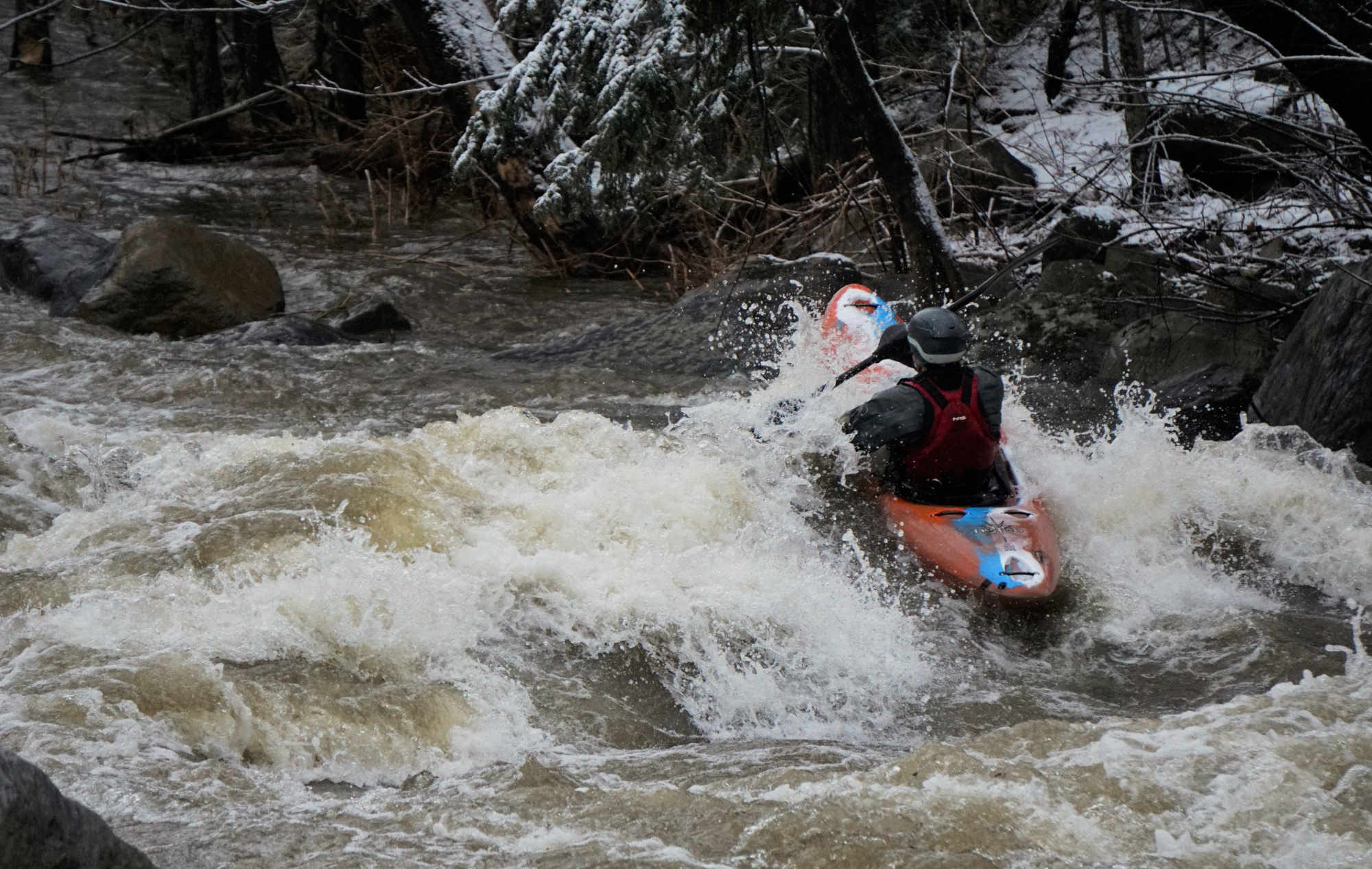
Turns out, this was my introductory VT river when I moved here in 1989. Going through the second rapid and seeing the rock wall on river right made me know this was a place to be.

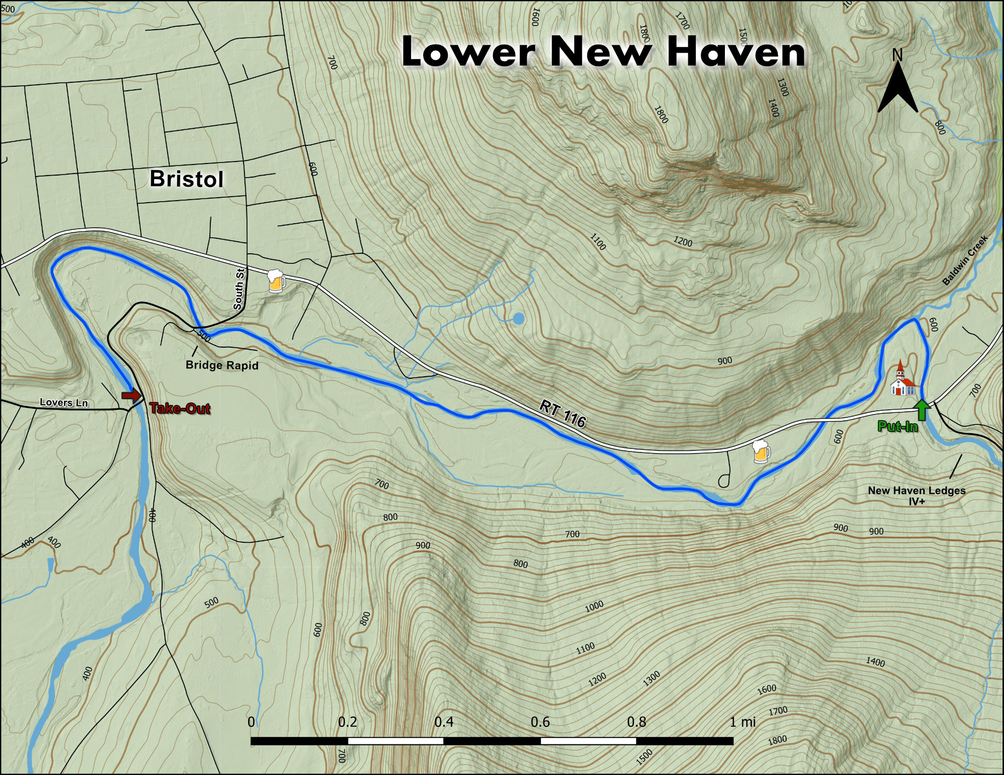
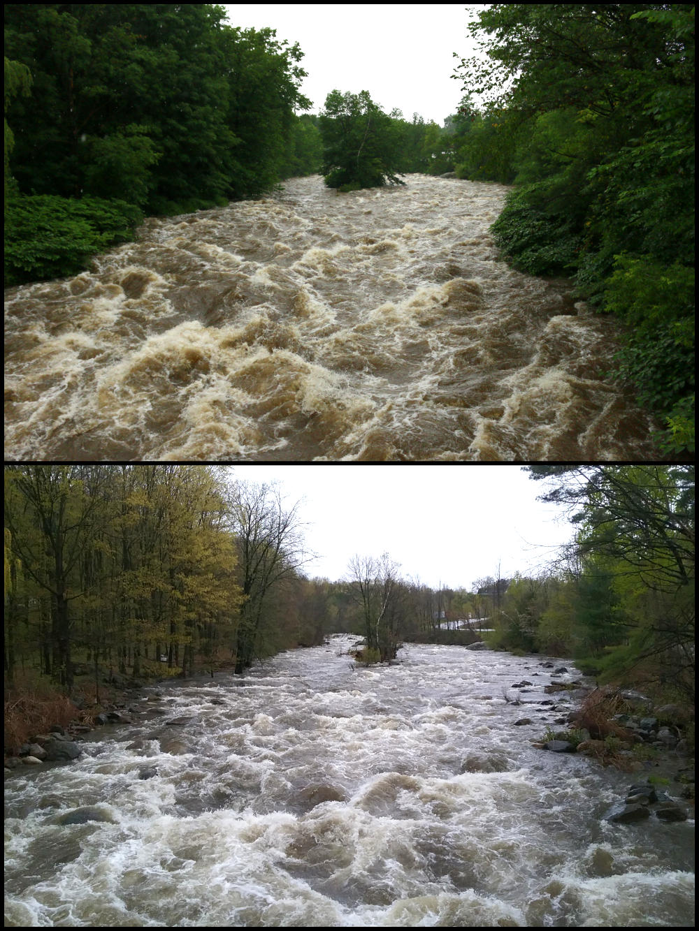
The lower New Haven (the LNH as opposed to the NHL New Haven Ledges) is wonderful intermediate run of about 2 1/2 miles. A convenient  alternative for when the New Haven Ledges are too high (though for some that never happens). Normally a low level would be 1,000 on USGS with medium at 2,000 and 2,500-3,000 and up a high level. You can expect some rock bashing at 1,000 and as the level increases things are ever better covered but the river gets faster and pushier. A relaxed paced run will take about an hour on the water.


The LNH starts, for many, with a slide from under the 116 bridge into a pool that is at the head of the first rapid. There is not much time to catch your breath before you’re into the first rapid. You can catch a couple of eddy’s through this rapid. Depending on the level, there may be a surf wave to ride about half way through it. This rapid, like all of the rapids on the river can be easily portaged.

Mike Mainer runs a rapid on the lower New Haven River Bristol Vermont Whitewater Kayaking
Mainer getting warmed up on a chilly December day.

After a short section of flat water you come to an island which splits the flow.  The usual route is left around the island. But the passage is occasionally  wood choked or has a down tree across it.  At lower flows it’s easy to boat scout.  At higher flows, you may want to get on shore to scout (river left) before heading down. The right side of the island is even more often wood choked but has the added disadvantage of being fairly shallow. Going on river left of the island gives you a fun but shallow II + rapid that ends where Baldwin Creek comes into to meet the LNH.  This is a good place to regroup before the next rapid.


The LNH takes a sharp left where Baldwin Creek comes in and you have another fun III that has some water to it.  The rapid is usually run center right but you can’t go wrong anywhere. Again, at lower flows, there are some rocks to avoid towards the top of the rapid.  This is good place to take out if you decide the river is too much for you. There are paths on river left that lead right back up to the put in from here.

Some quick moving water leads you to the next rapid which ends at the second Rte.116 bridge. At medium levels this has some small holes to avoid, or enjoy.  This can be run many different ways, with eddys and holes used for the slack water to navigate across and down the river. As the flow increases the right side line tends to be a bit easier. 

Again some quick water leads to a straight forward 100 yards of class III-. On the sides of the river you can see how the 1998 flood altered the river flow. Irene followed in 2011 and further changed the river bed. As you wind your way downstream parts of Rte 116 / 17 were eaten away by both those floods.

This is the longest stretch of quick / fast water on the river. Fortunately, it is interspersed with plenty of chances to boof rocks and surf various small waves. Once you reach an odd looking cement structure (it sort of looks like a concrete dock) on river left, you’ll be at the top of a rapid that is generally run left to right but can be made to go with a few different lines. As you come out of this rapid you will see the South Street Bridge up ahead. The rapid above and below the bridge is often scouted by pulling up on river right and going up on the bridge.  This rapid has multiple lines with a sneak left line coming in at high water.  This is probably the toughest rapid on the LNH. The lower section of the rapid (below the bridge) is best run center left to left at low flows. (Avoid the hole on the hard left of the river just as the rapid starts).  As the water increases the middle line opens up because the rocks are better covered.

As you go by the pulp mill on your left and the old town dump on your right you eventually come to a choice of three channels.  Right is the best choice for lower water and is in general a bit more fun then the other two. Once you’re around the island you enter the last extended rapid before the take out at Lover’s Lane Bridge (river left takeout). The first part of the rapid has some bigger water and bigger holes then the second half. Plenty of time to boat scout your lines and play around going from one side of the river to the other. The last section is more continuous and at lower flows can be a study in rock avoidance. And at higher water, well, it’s just a hoot. Just a fast III / III + jumble of white water before the take out under the bridge. 

Added bonus…Hogback Mountain Brewery is now open on the banks of the New Haven mid way down the run! Does it get much better?

Mike Mainer runs a rapid on the lower New Haven River Bristol Vermont Whitewater Kayaking
Heading into the section below the bridge at a nice high level.

Stepping Stones

Guide to The Lower Mad River Vermont Whitewater Kayaking
Not quite ready for the LNH? The Lower Mad is a great place hone skills.
Creek VT river guide coming soon
If you like the LNH, then you're sure to enjoy the Cold River.
North Branch of The Lamoille Guide Vermont Whitewater Kayaking
Looking to step it up? The NBL will satisfy those looking for more of a challenge.