Flint Brook

The Stats


Location:
Roxbury
Length:
1 mile
Class:
V-
Flow Direction:
South East

Starting Elevation:
1424′

Ending Elevation:
1100′

Average Gradient:
324′ / mile

Rapid Type:
Tight and continuous ledges, boulders and slides.

River Grade:  A-


The rapids are continuous, the eddies are tiny, and the gradient is unrelenting.  Flint Brook is a true gem of a micro creek.  Don’t let its diminutive size fool you, as the 1 mile run will keep you on your toes for the entirety.  From the put-in down, paddlers are treated to a non-stop descent through steep boulder gardens and over tight bedrock ledges and slides.  The minuscule watershed (2.75 miles at the put-in) means it takes a big water event for Flint to run, but catch it with flow and you are in for a treat.  Just don’t miss the take-out.

Dave Packie profile picture Vermont Whitewater Kayaking

Meet Your Local Guide:

 
Dave Packie

Dave is the Northfield local (perhaps the only paddler in town?).  If it is in the Dog River watershed, he’s either paddled it or fished it.  Flint Brook is no exception.


Homebase: Northfield, VT
Local Runs:  Flint Brook | Devil’s Washbowl

Directions

From Northfield:  Follow 12 south past Norwich University until you reach the junction with 12A.  Take 12A south for ~ 8 miles until you see Oxbow Road on your right.   Follow this up to reach the take out & put in listed below.


From Randolph: Follow 12A north for ~13 miles until you see Oxbow Road on your left.  Follow this up to reach the take out & put in listed below.

Put-In

From the take out follow Oxbow Road upstream crossing W. Hill Road where the name then changes to Rice Tract Road.  Continue until Ordway Road comes in on the right and you reach a gate on Rice Tract.  Find a place to park away from the No-Parking signs and put in at the bend in the creek.  You can go up high to add a bit more, but the best action is downstream.

Take-Out

Park on the shoulder across from Rabtoy Road.  You will have to hike your boats out of the gorge back up.  Take out after the bedrock rapid with the bus-sized boulder perched vertically in the center. 

FLOW INFO

Online Gauge:

Dog River @ Northfield Falls
Ayers Brook @ Randolph
​​

Flow Range:
Dog River:  1300 – 2500
Ayers Brook:  350 – 800


Visual Gauge:

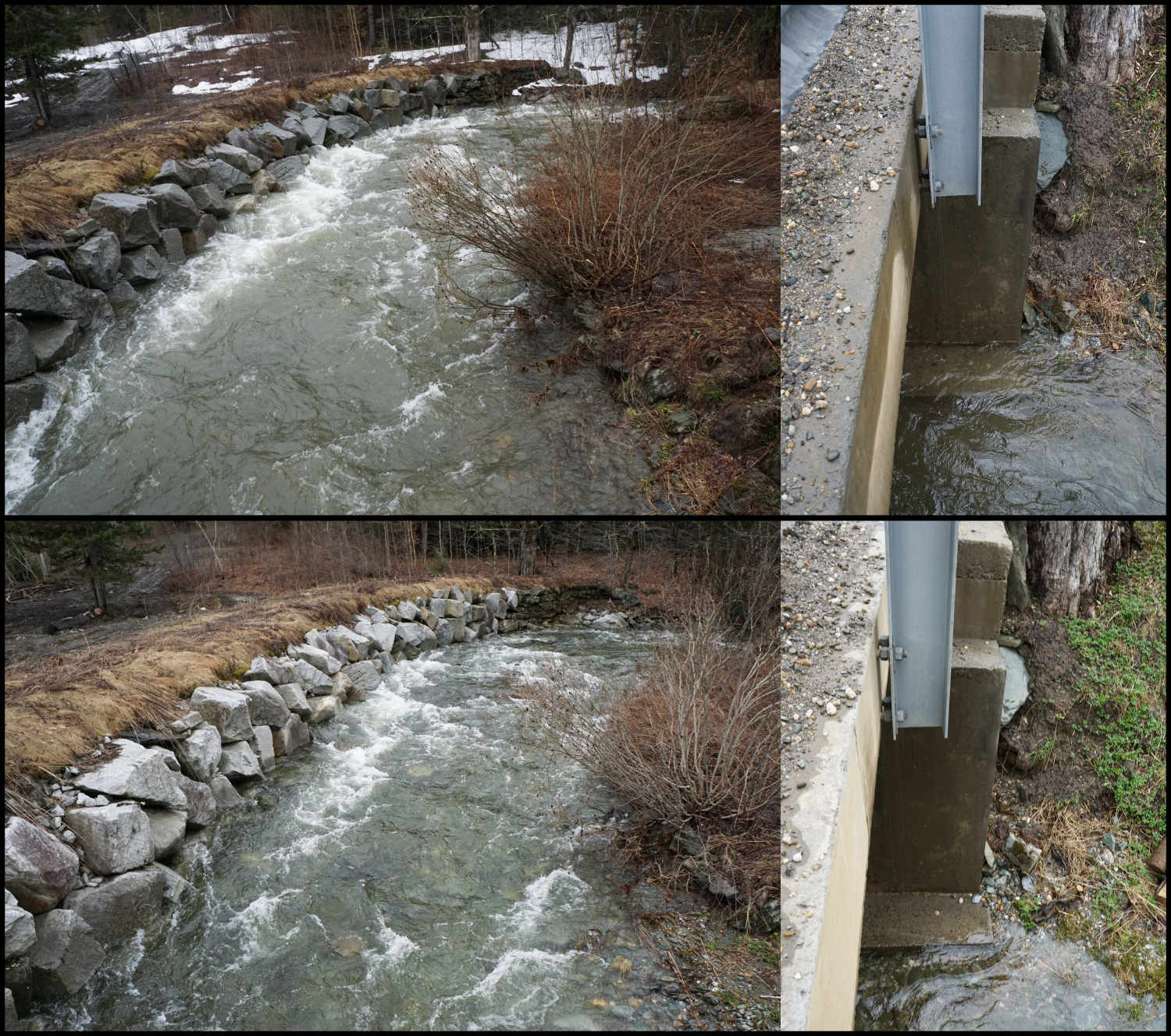
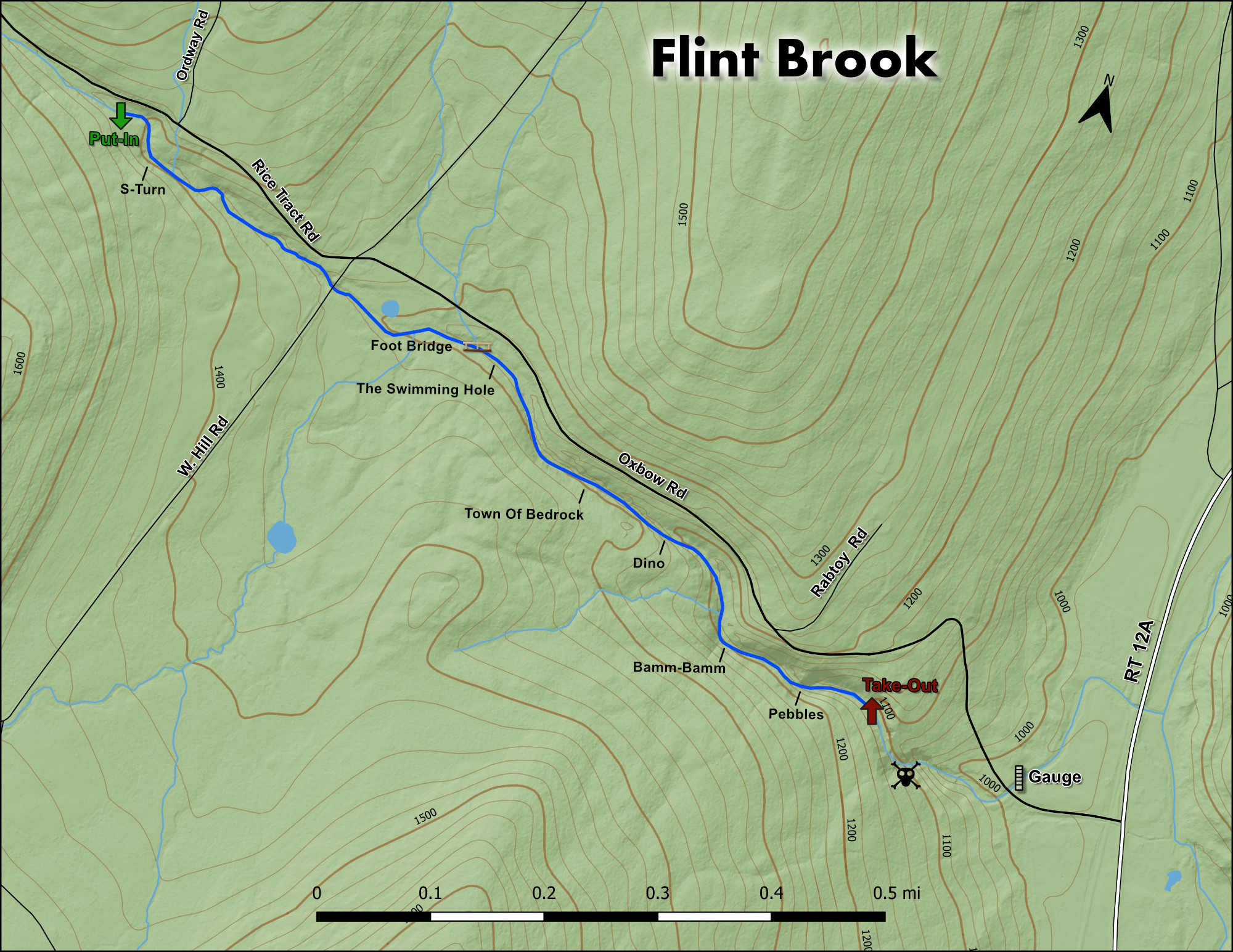
Downstream river left abutment of 1st bridge crossed on Oxbow Road.


Flow Range:

1″ below the abutment footing: Low
Even with the abutment footing: Medium Low
1″ over the abutment footing: Medium
2″ over the abutment footing: Medium High
3″+ over the abutment footing: High

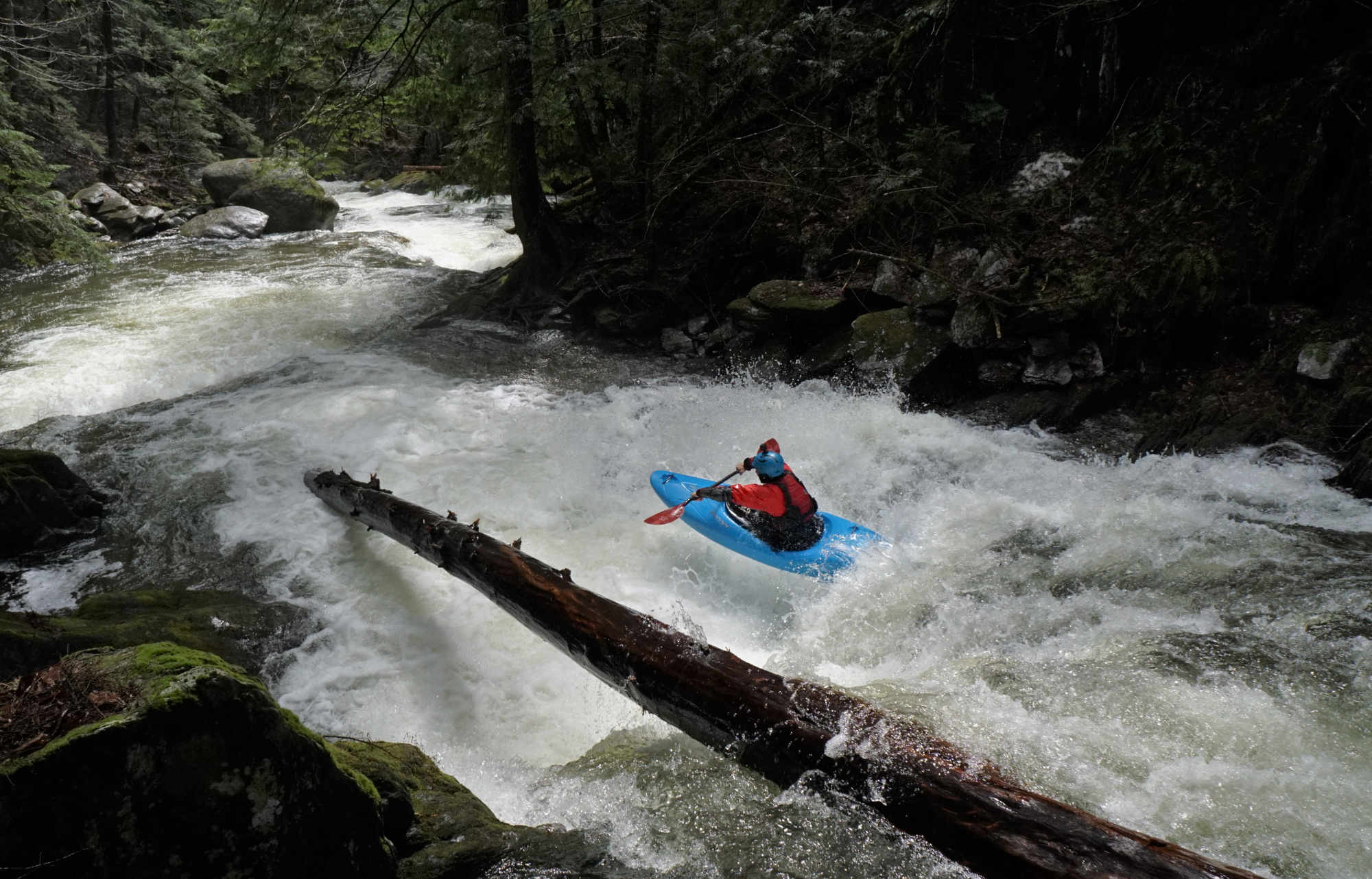
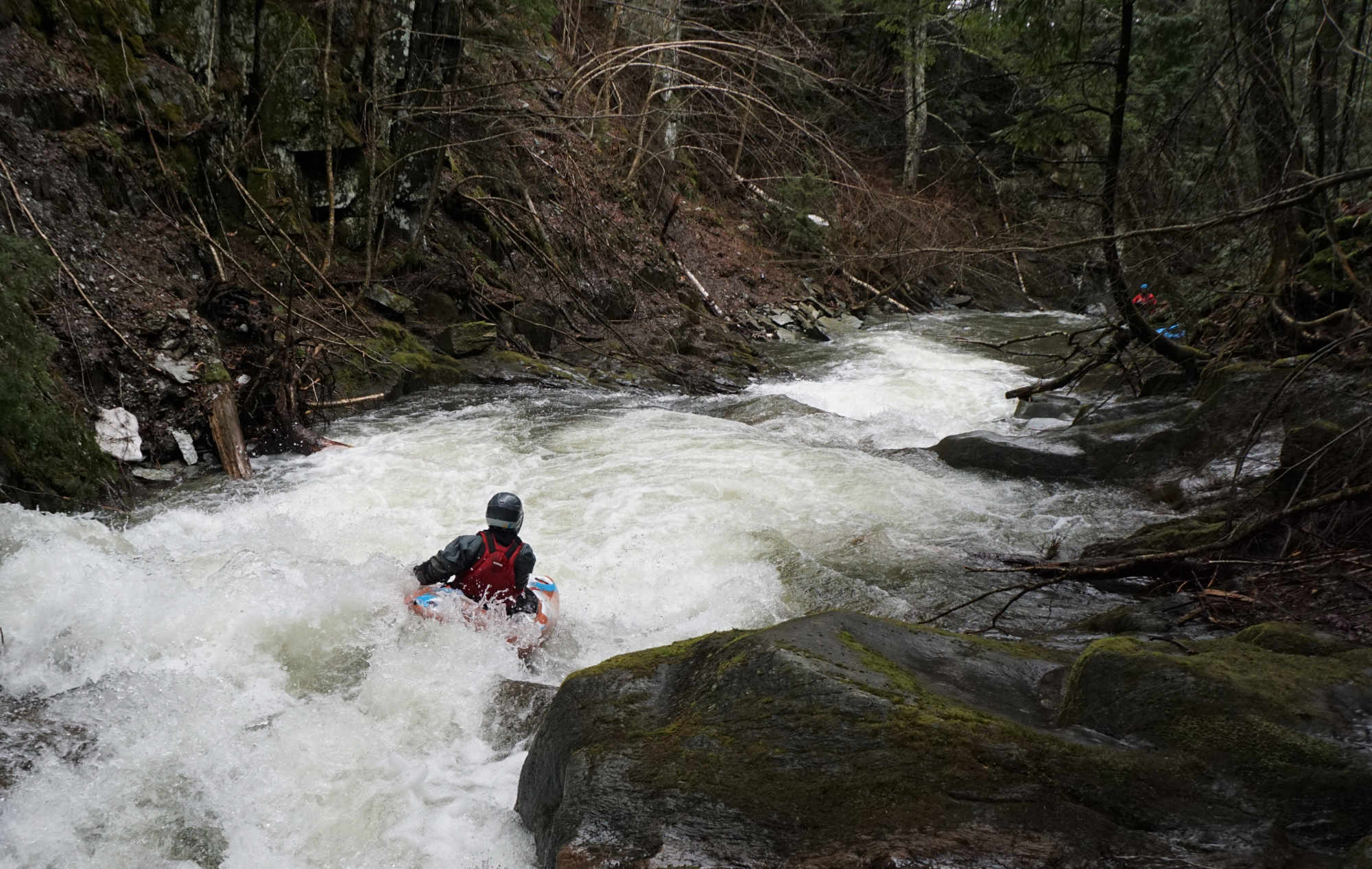
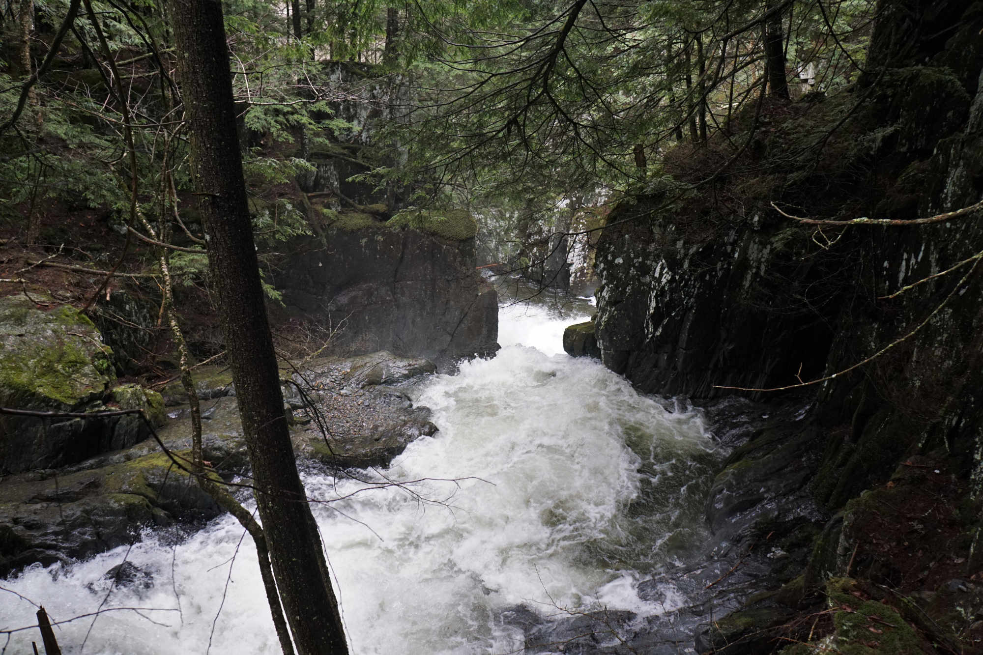
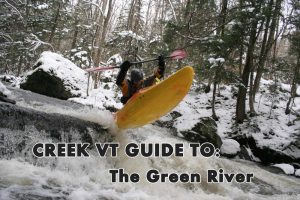
Top pictures show a medium-high level, bottom pictures show a medium low level. 

The Run

Description: D Packie | Photos: S Gilbert

Safety notes: 

Make sure you know your take out before putting on – especially if the water is high.  A ~60ft unrunnable (or at best highly marginal) tiered waterfall awaits 100 yards below the take out.  The lead in rapid has no real eddies and blundering into it would be a major mistake.

Mike Mainer boofs the Swimming Hole Rapid Flint Brook Vermont Whitewater Kayaking
Mike boofs 'The Swimming Hole' ledge below the foot bridge

When DWB and Stoney brook are too low, head south on Rt 12a to Roxbury. South of “Town”, in the Johnny Cake Flats you’ll see Ox Bow Rd on the right. To scout, park on the road at the top of the STEEP hill on Ox Bow Rd and hike in, follow your ear and the gradual ridge down to terminal falls.  Looking here first will show you exactly what you are dropping into.

Stopping above the falls safely is clearly the crux of this run.  When you see Flint, you’re either in, or you’re out.  There is an option to stop upstream of this last and steepest section at low but fluid flows.  The short hike out there is difficult, but not out of the question.

Jordan Vickers on Flint Brook Vermont Whitewater Kayaking
Standard action on Flint.
Jordan Vickers runs Town of Bedrock Flint Brook Vermont Whitewater Kayaking
Jordan finishing the exciting three stager - 'Town of Bedrock'.

There is a bridge up about a mile where two nice little waterfall-rapids, the first manky, and the second nice, start you into the gorge.  

The gorge starts with some boogie before hitting full gear.  Welcome to the Town of Bedrock.  Continuous, woody, amazingly runnable, beautiful…..did I say continuous?

Jordan Vickers runs Dino on Flint Brook Vermont Whitewater Kayaking
Jordan finds the boof flake on Dino. Notice the gradient downstream.
Mike Mainer on Bamm Bamm Rapid Flint Brook Vermont Whitewater Kayaking
Mike on the two stager -'Bamm-Bamm'

Wood and large rocks move around in here quite a bit.

The last third of the gorge ramps up considerably just after the flow splits around a giant boulder.   It becomes increasingly more difficult to stop and hike out.

Jordan Vickers in the middle of Pebbles Rapid Flint Brook Vermont Whitewater Kayaking
Jordan making the move in the beautiful and involved final rapid - 'Pebbles'.
Waterfall on Flint Brook Vermont Whitewater Kayaking
What awaits if you miss the takeout.

Due to the constricted nature of this tiny brook, small changes in flow can have a profound impact on conditions in the gorge.  This is as committing as a road-side run as you’ll find in Vermont.

Stepping Stones

Guide to Devil's Washbowl Vermont Whitewater Kayaking
Not quite ready for Flint Brook? Devil's Washbowl is tons of fun but a good bit easier and just up the road.
Guide to the Green River Vermont Whitewater Kayaking
If you like Flint Brook, then you're sure to enjoy The Green
Creek VT river guide coming soon
Looking to step it up? East Granville Brook is 10 minutes away and offers even more gradient in an even tighter gorge.