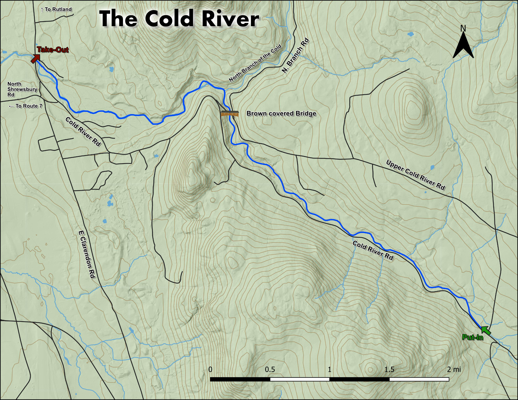


Online Gauge:
OTTER CREEK AT CENTER RUTLAND, VT
Flow Range:
1750 – 3750
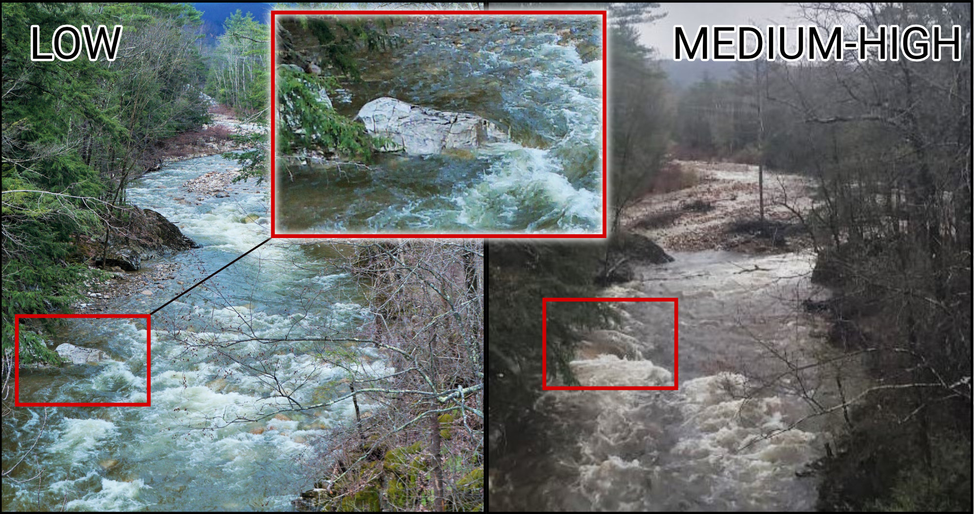
Visual Gauge:
Ledge on river right 200 yards upstream from takeout bridge.
**Note this area is in a fairly constant state of flux, as such this gauge will likely change over time. If you are unsure of the level you can drive upstream to the Brown Covered Bridge and view the rapids here.**
Flow Range:
Eddy behind but no flow going over: Low
Water just spilling over: Medium
Water covering entire ledge creating pour-over: Medium High
What ledge?: High+