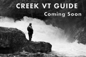


The Big Branch of Otter Creek
The Stats
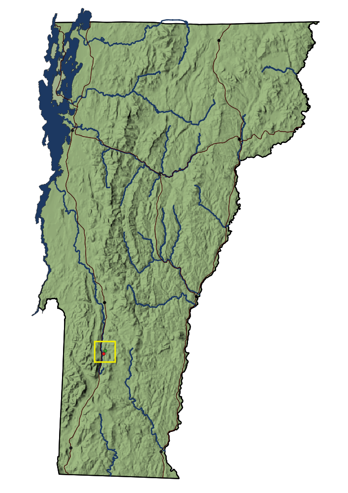
Location:
Mt Tabor
Length:
1.35 miles (from Standard Put In)
Class:
V
Flow Direction:
Southwest
Starting Elevation:
1210′
Ending Elevation:
780′
Average Gradient:
318′ / mile
Rapid Type:
Continuous boulder Gardens
River Grade: A+
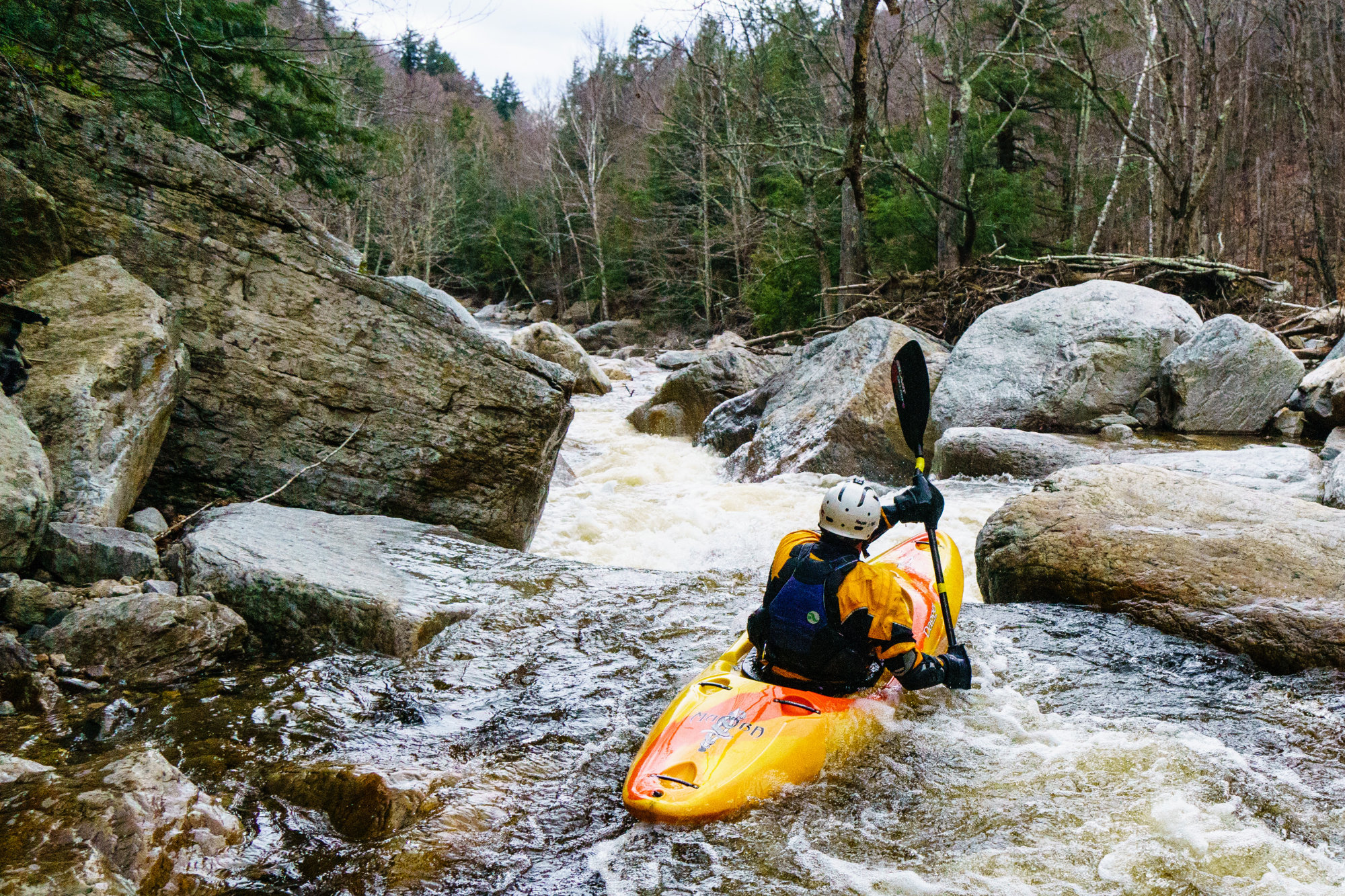
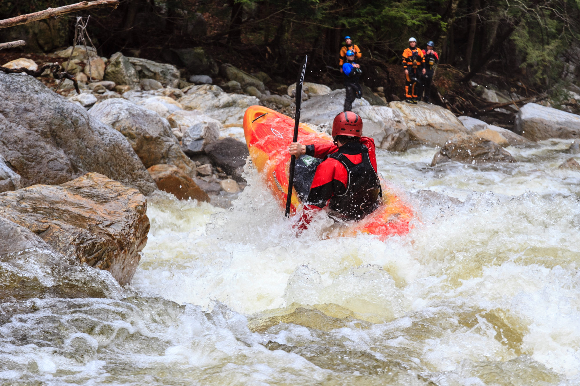
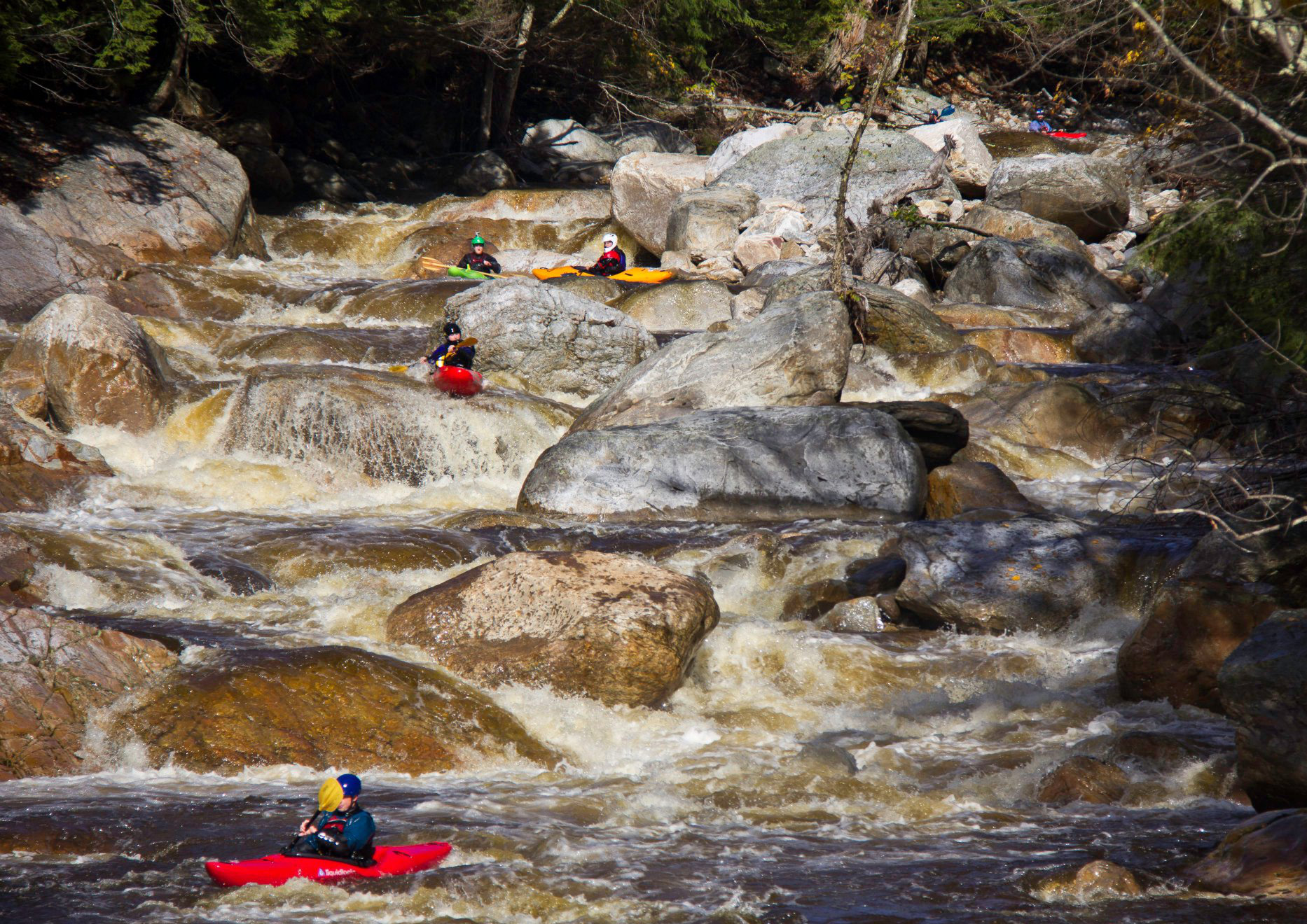
No discussion about the best river in New England is complete without mention of The Big Branch of Otter Creek. The run boasts a non-stop maze of complex boulder gardens, with no mandatory portages, frequent flows, and fantastic scenery. This allure draws many to the put in, but beware, as the creek has a reputation for serving up carnage to the unprepared. For those up to the challenge, the reward is a natural playground like no other in the state. Simply put, The Big Branch is one of the best Vermont has to offer.


Meet Your Local Guide:
JUSTIN CRANNELL
Few boaters can claim to have run the Big Branch more than 50 times in their lives. Justin has done so in a single spring. You would be hard pressed to find somebody who knows the complex lines and features of the creek as intimately as Justin. If you are lucky enough to find yourself on the water with him, he’s the one to follow.
Homebase: Queensbury, NY
Local Runs: The Big Branch of Otter Creek
Favorite VT River: The Big Branch of Otter Creek
Favorite VT Rapid: Silver Bridge – Big Branch
Favorite Run Outside VT: Deschutes River, OR – Meadow Camp Section
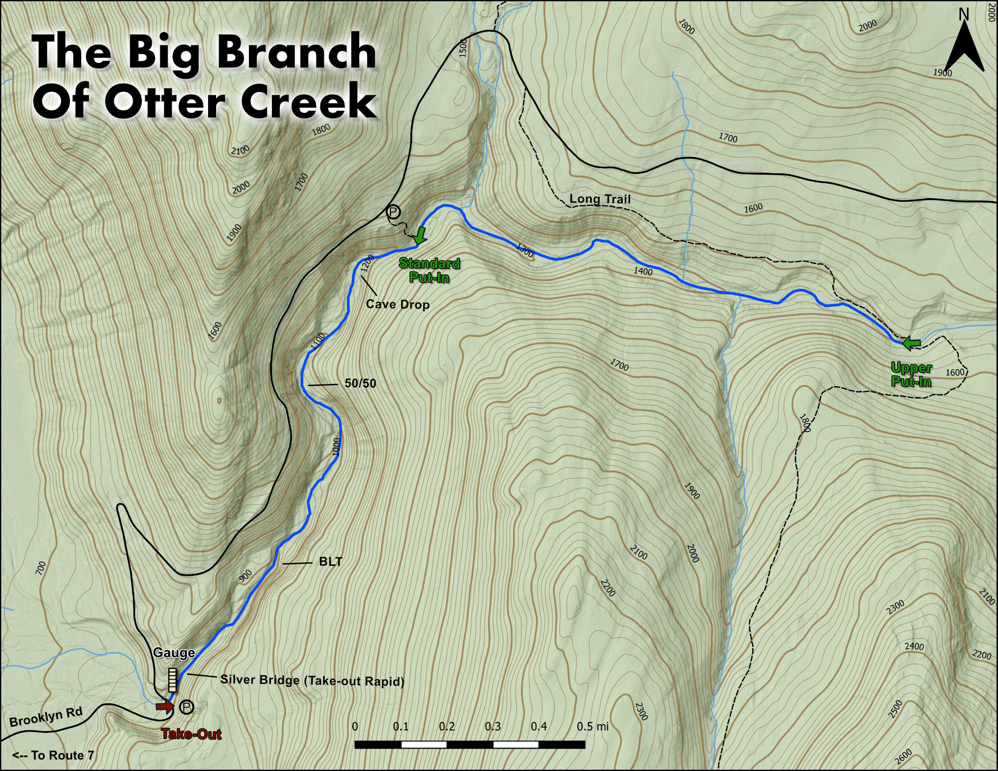
Put-In
From the take-out continue up Brooklyn / Mt. Tabor Road for a little over a mile and a half until you reach the Big Branch Lookout. Parking is in the lot on the right. From here make your way down the steep trail to put in – right into the action.
Take-Out
From route 7 in Mt. Tabor, head east on Brooklyn Road for 1 mile until you reach the bridge across The Big Branch. Parking is in the obvious area before the bridge.
FLOW INFO
Online Gauge:
Ottauquechee River Near West Bridgewater, VT
Flow Range:
125 – 400
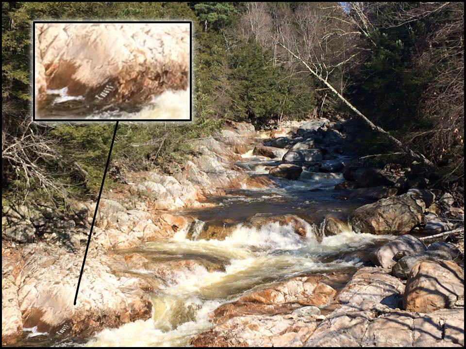
Visual Gauge:
Painted gauge on the bedrock on river right in the takeout pool. There are 10 marks with the middle one marked as “0”.
Image shows a flow of just below 0
Flow Range:
1 to 2 : Low
3 to 5: Medium
5+: High
The Run
Description: J Crannell | Photos: N Gottlieb
The Big Branch is easily regarded is one of the best runs in the entire Northeast. Rarely does a lap on this classic disappoint. Guessing levels can be a bit tricky as there is no gauge on the river. The Big Branch generally requires more water than other area creeks to run and typically runs in the spring and fall. Springtime snowmelt provides the most dependable flows but if you are dependent on rain look for .5-1 inch minimum depending on ground saturation levels. For a river gauge look to the painted gauge on the bedrock on river right in the takeout pool. There are 10 marks with the middle one marked as “0”. Look for 1-2 as low, 3-5 medium, and 5+ as high although runs down to -5 have been made in desperate situations. Aside from great whitewater, the Big Branch has reliable cell service, a pit toilet at the put-in, and camp sites close by.
This description is for the lower (most commonly run) section of the river. At higher flows you can potentially paddle the upper section (4 miles) although it is still unclear the wood situation is as its rarely ever run. This upper section is not as steep with easier rapids as compared to that of the more paddled lower section. Paddlers wishing to hike out after paddling the upper section will have a difficult scramble up the steep trail for the normal put-in. For your first time allow for plenty of time getting out of your boat to scout or check for wood. Ideally its best to follow someone down for your first time.
**Take notice**
Forest rangers have currently closed off the put-in trail to the general public due to unsafe conditions and landslides in the past years. At request of the rangers do not remove the wood pieces where the old gate used to be. To gain access to the river go to the far right of the wooden fence and continue to follow the footpath down the ridge to the river.
Singletrack: IV- .18mi
In the past this has been one of the most common portages on the river due to its large mass of jumbled rocks that contained several sieves and undercuts at most flows. Fortunately, Hurricane Irene left one relatively easy channel on river left.
Slide up and over the rock ledge on river left to drop into a shallow pool. Follow the water and keep it straight to hit one final ledge and finish back in the main channel. If you want to avoid the mandatory boat abuse portage left.
Open Wide IV+ .33mi
Stay left on bedrock slide as the river makes a sharp right turn. From here out there are multiple lines starting center but work to the left or right as the rapid continues. A short pool just before back-to-back ledges is typically run on the left and also signals the approach of 50/50.
first ledge in the rapid. Worth a scout if unfamiliar. Portage on the left. At high flows you will be unable to eddy out on left above the rapid. Start portage or scout earlier as needed.
50/50 V .43mi
The river makes a hard left turn and falls away sharply; this is one of the steepest sections on the river. Stay left to ride down the main flow or shift to the middle to hit a number of boof ledges with holes backing them up. There is also a hidden sieve on the right side of the bottom of the rapid.
Dr Ed’s Ledges IV+ .47mi
This is a series of 4-5 ledges and slides over bedrock. Run this first horizon line far left or right to stay clear of the sieve in the middle.
Double Trouble IV+ .57mi
A Large boulder in the middle splits the creek into two channels. The boulder is undercut and the left channel has a tendency to accumulate wood that is impossible to see until its too late.
Halfway Home IV+ .63mi
A few hundred yards of boogie water finish in a jumble of rocks which break the river into 3 slots. The left and right slot both collect wood and have had a number of vertical pins. Go in the center slot.
Boof Central Station IV+ .78mi
This section is about 200 yards long and contains a number of great ledges and boofs. Watch out for a few sticky holes. There is also a large collection eddy at the bottom on the left to gather swimmers and gear should your line not work out so well.
The Rapid Above the Rapid Above BLT V- .86mi
A nostalgic name to when only 3 recognized rapids described the entire run. This rapid consists of a 4-5 ft drop with a twisting lead in. Unfortunately, all the water lands on rocks. There is a possibility at medium and higher flows to get right when it’s more padded. Beware the middle, as there is a massive piton rock that may or may not be visible. A portage and seal launch off the angled rock below the main drop is the frequent option for many.
Blt V- .93
BLT is constantly changing and full of wood. Scouting here to look at the current conditions is advised. There is a sieve at the bottom of the left channel. Look to stay river right if possible. Portage on the right.
Graceland IV 1mi
A hundred yards below BLT things begin to pick up again. A short section of steep channels will quickly mellow out to create on of the longest boat scout-able stretches on the river.
Silver Bridge V- 1.25mi
This one is a little gem left over by Irene. Start off with one of the best boofs on the river. Then head downstream to navigate a sticky ledge and continue your way through a slot in the middle. Avoid the right slot if at all possible due to large pin/piton potential. The typical move is to hit the middle slot with speed to go up and over the middle rock.
Stepping Stones