Devil's Washbowl

The Stats

Location:
Northfield Falls
Length:
1.35 miles
Class:
IV+
Flow Direction:
South East

Starting Elevation:
1285′

Ending Elevation:
925′

Average Gradient:
267′ / mile

Rapid Type:
Small falls and stacked ledges.

Put in:
(-72.71529, 44.2113)

Take Out:
(-72.69360, 44.20440)

River Grade:  A-

On the Delorme Gazetteer, the stream known as the Devil’s Washbowl does not appear.  Upon seeing the put-in, even the most adventurous creek boater will question if they are in the correct place.  But trust that downstream lies a truly fantastic little run.  The DWB is stocked with ledges and falls, and contains a 1/4 mile stretch of pure fun that rivals anything in the state.  If that isn’t enough, near the end of the run is the single greatest boof found in Vermont.

Dave Packie profile picture Vermont Whitewater Kayaking

Meet Your Local Guide:

 
Dave Packie


Dave is the Northfield local and pioneer of Devil’s Washbowl.  He discovered it, cleaned it, took part in it’s first descent.  You won’t find anybody with more intimate knowledge of the DWB than Dave.


Homebase: Northfield, VT
Local Runs:  Flint Brook | Devil’s Washbowl

Directions

Find your way to Northfield Falls and onto Cox Brook Road crossing first the Dog River Covered Bridge and then Cox Brook Covered Bridge.  The take-out is approximately 3 miles up the road, where the DWB confluences with Cox Brook – this will be on the south side of the road (left going uphill).   To reach the put-in, travel another 1.5 miles up Cox Brook / Moretown Mountain Rd and take a left onto Washbowl Road.  Follow this for just shy of a mile until you come to the tiny brook crossing.  This is your put in (yes really).

Put-In

From the take out follow Cox Brook / Moretown Mountain Rd uphill for 1.5 miles.  Left onto Washbowl Road.  Follow for ~1 more mile to reach the put in.

Take-Out

Park out of the way on Cox Brook / Moretown Mountain Rd.  You will have to take out before the bridge and bushwhack a very short distance on river left to get back to the road.


Travel carefully once you near the end of the run as there is a nearly impassable bridge at most boatable flows.

FLOW INFO

Online Gauge:

Dog River @ Northfield Falls


Flow Range:
1750 – 3000 cfs


Visual Gauge:


Visual inspection of Cox Brook is generally a good indicator.  A specific gauge has yet to be established, but if Cox Brook looks high, you are probably good to go.

Image shows above the put in at a medium level.  Yes it really is that small to start and you may have to walk your boat a bit before it becomes reasonable, but don’t worry shortly downstream a confluence adds plenty of flow.

The Run

Description: D Packie | Photos: S Gilbert

Safety notes: 

Be careful as you approach the end of the run.  There is a bridge that at normal flows will be essentially impassable.

Ben Guttridge Scouts Aspen Falls on Devil's Washbowl Vermont Whitewater Kayaking
Ben G Scouts Aspen Falls

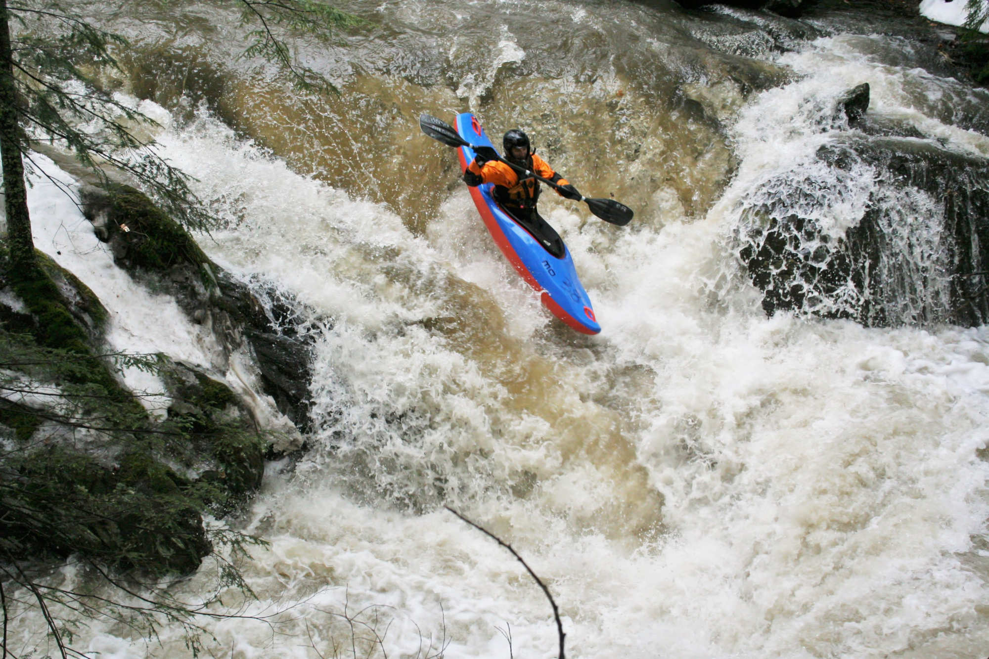
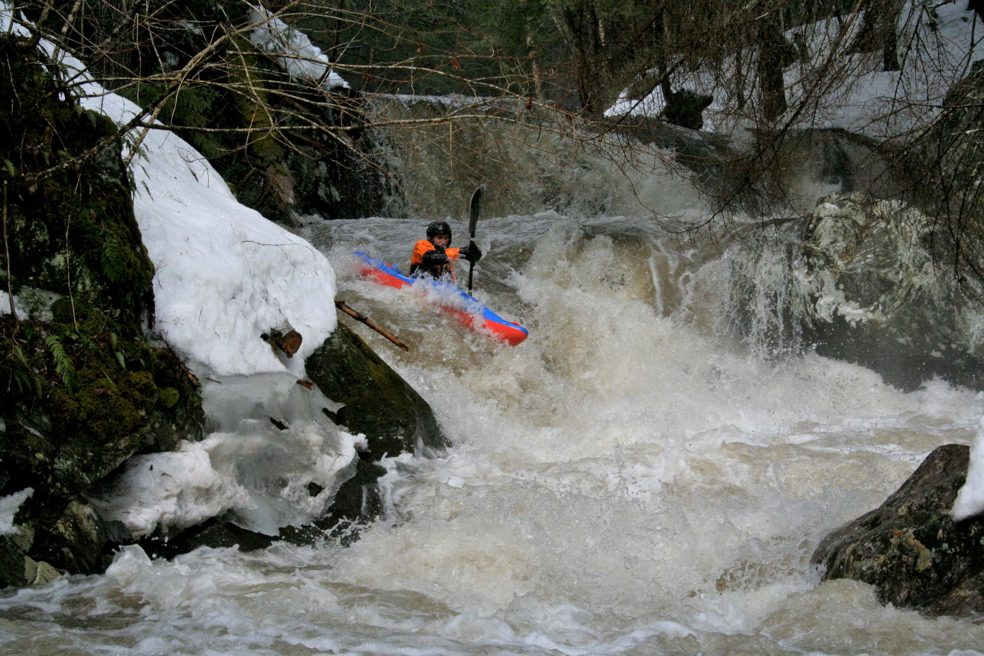
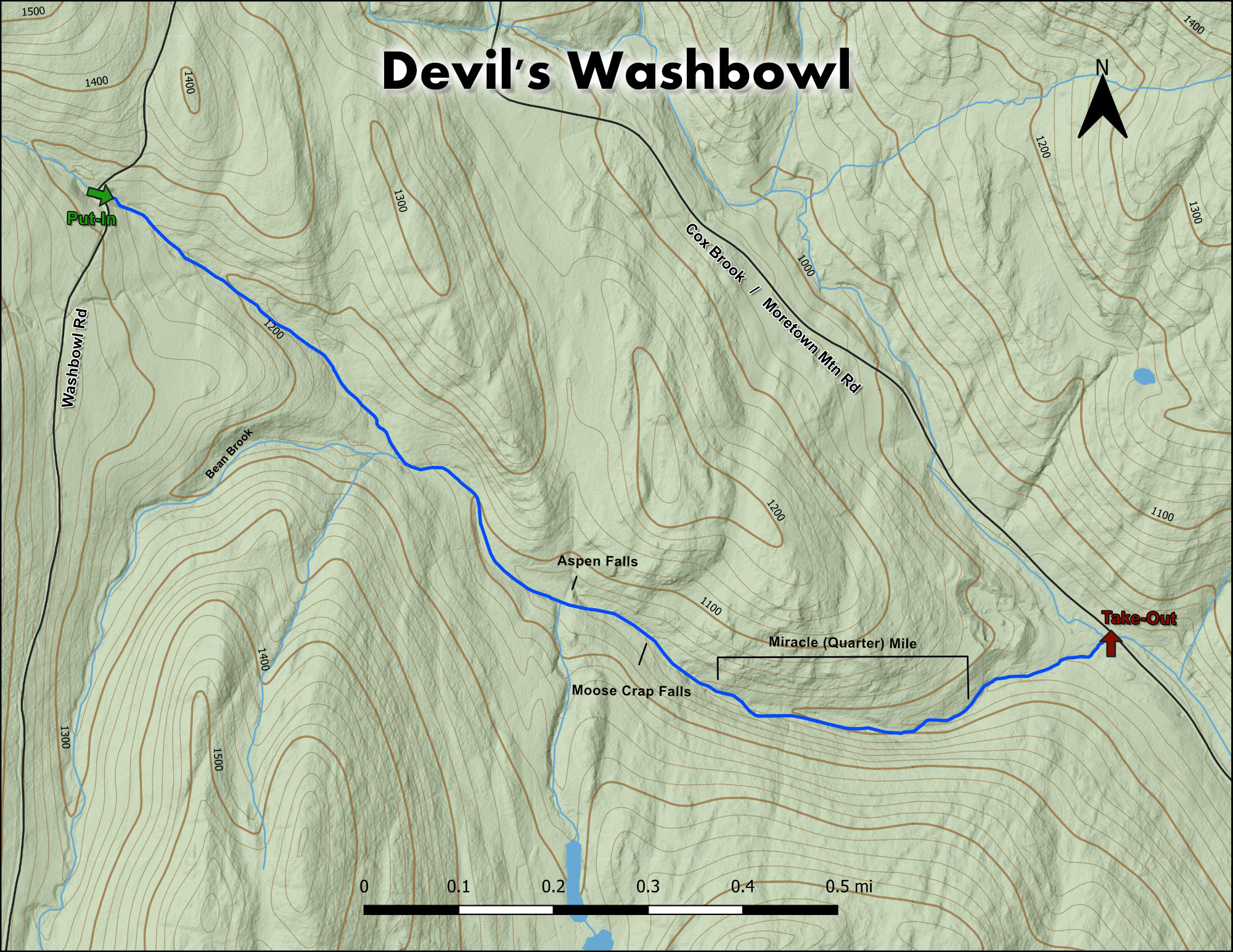
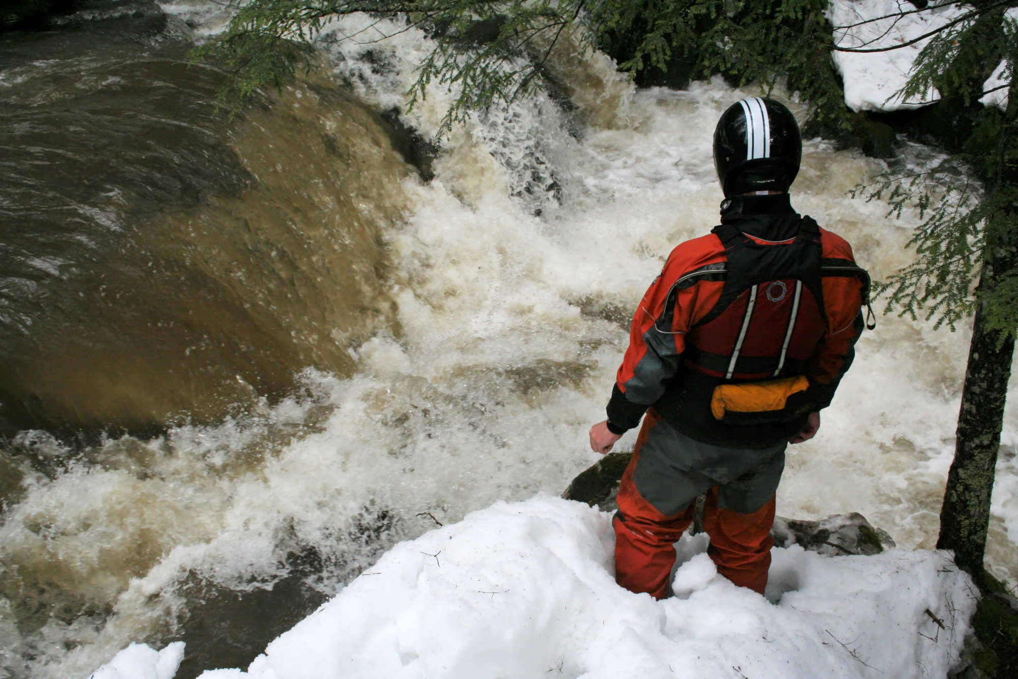
Home of the Pig Man, a well-documented piece of Vermont folk-lure, this Micro creek is a real special place.  This run is flashy; the Dog needs be heading for 2000cfs as you turn up Moretown Mtn Rd, aka Cox Brook Rd in Northfield Falls.  You want the brook to look full, and hopefully it’s still raining.  If you do catch this gift at just that right time, you are in for something really special.


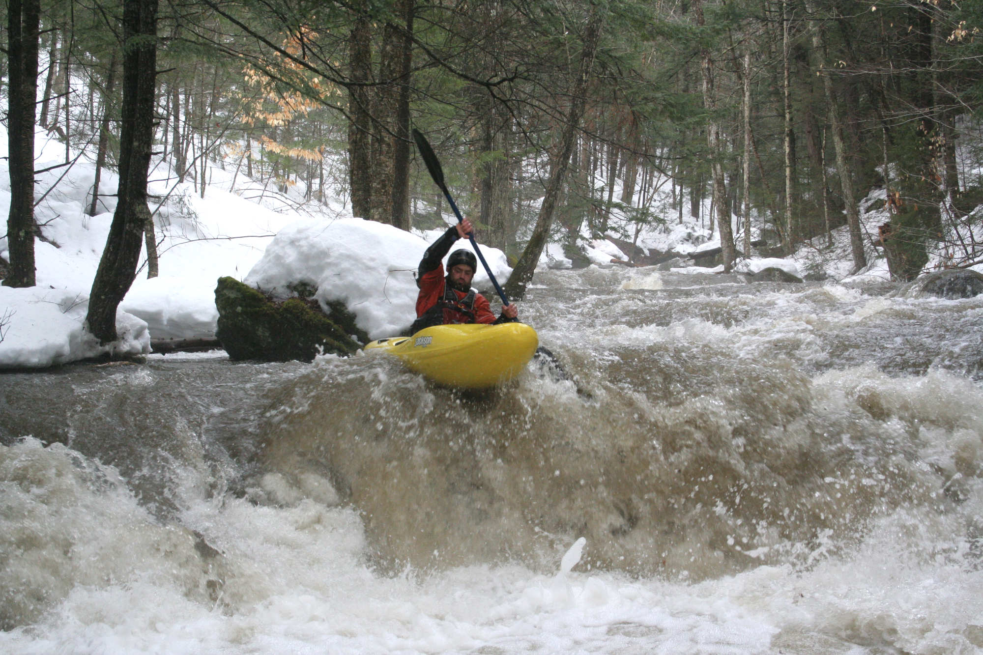
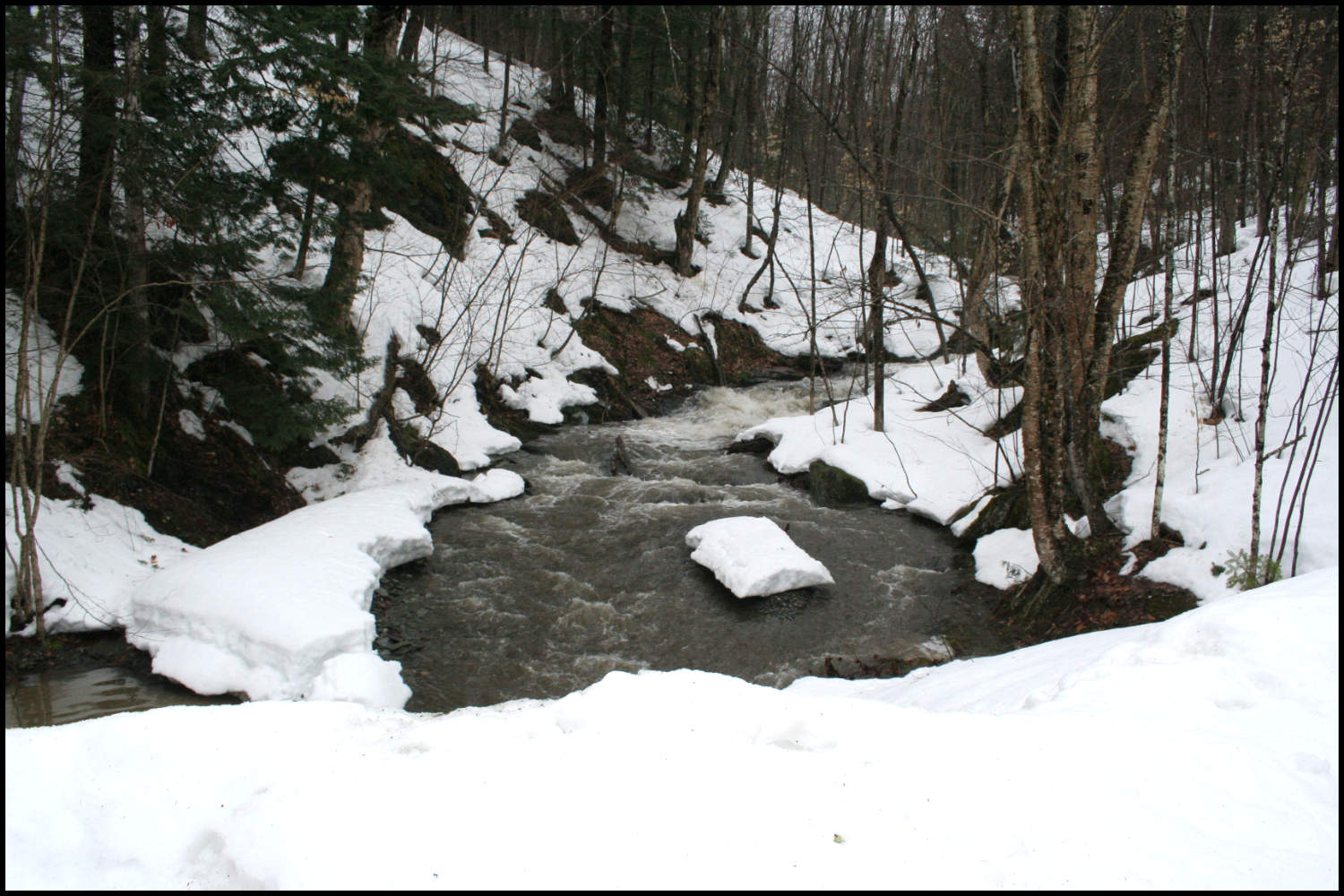
From the put in the brook will look way too small, boney, and once again will attempt to dissuade you from exploration.  Portage down the old road on river left and put on where you like.  If your boat is full of welds, you might want to hike in the entire ¼ mile until Bean Brook doubles the flow from river right, and the fun begins. 

Bean Brook is the first notable rapid on the run.  Hey-diddle, down the middle, and angle left at the pillow so as not to piton, there is some pin potential here if you stuff it deep under the boulder  This rapid is a super fun flush through a little gorge.  Easy scout on the left.  Any trouble here and it’s a short walk back to the car.   A quick float down some boney flats brings you to Aspen Falls, first run by Linsky, this marks the beginning of the Miracle Mile of the Wash Bowl.   It’s a gorgeous little waterfall rapid.  Scout on the right and please be low-impact on the flora.

Erik Debbink runs Aspen Falls on Devils Washbowl Vermont Whitewater Kayaking
Debbink drops into Aspen Falls
Erik Debbink runs Moose Crap Falls on Devils Washbowl Vermont Whitewater Kayaking
Debbink on the second stage of Moose Crap Falls

After some room to collect yourself, boogie down to the next major horizon.  Scout right again.

Depending on flows, you might want to walk down the road for a piece, as things can all run together pretty easily.  Eventually things flatten out for a moment.  Old concrete bridge pylons on the right mark the last section of fun ledgey,  creeking; and be aware that bridge that you don’t want to go under can come up fast. 

Eric Sorenson runs a rapid on Devil's Washbowl Vermont Whitewater Kayaking
Eric S working his way down the stretch of heaven below Moose Crap Falls

Stepping Stones

Guide to Patterson Brook Upper White River Vermont Whitewater Kayaking
Not quite ready for Devil's Washbowl? Patterson Brook is a great place hone skills.
Guide to the Green River Vermont Whitewater Kayaking
If you like Devil's Washbowl, then you're sure to enjoy The Green
Guide to Flint Brook Vermont Whitewater Kayaking
Looking to step it up? Flint Brook is just down the road for those looking for more of a challenge.